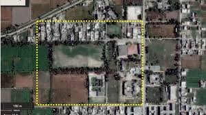
New Delhi: The strategic brilliance behind Operation Sindoor has come to light, revealing how India harnessed cutting-edge satellite intelligence and geospatial technology to identify and strike high-value terrorist targets in Pakistan and Pakistan-occupied Kashmir (PoK).
Executed with pinpoint precision, the mission marked a defining moment in India’s evolution of science-driven military strategy. High-resolution satellite imagery enabled defense planners to map enemy bases, track troop movements, and analyze terrain — all without setting foot on the ground.
Crucial support came from the Indian Space Research Organisation (ISRO), which, in coordination with military intelligence, provided real-time data that made surgical strikes swift and highly effective, minimizing collateral damage.
Military analysts have hailed the operation as a textbook example of technology-led warfare, showcasing India’s ability to blend tactical power with space-age reconnaissance. Operation Sindoor is now being seen as a game-changer in modern combat, reinforcing India’s readiness to counter threats with precision, speed, and scientific excellence.


